DFAUS Offsite Mandate for an Undetermined Stewardship: Lorne Deployment SHIPRITE 2025
Version 444
Authors:
https://orcid.org/0000-0002-0999-6196
https://orcid.org/0000-0002-5774-3089
WARNING: This deployment is at high risk of DENIER FACTION TEMPORAL RUPTURE. Classification 4: High risk. Review Abandon Ship protocol below.
BACKGROUND
The LORNE SHIPRITE DEPLOYMENT is a DFAUS initiative that takes place in Earth Year 2025. The offshore deployment tasks DFAUS delegates with navigating the complex terrain of environmental crisis using proprietary mandate protocol. Each delegate has been algorithmically selected for optimal contribution to the mission.

THE OPERATOR
The Operator will have access to some or all of the Osprey Lab Unit Capsule instruments in order to collect and analyze data across various time periods. The Operator will work onsite to engage with opportunities to generate actionable climate scenarios (Priority Classification Futures).

SEA WITCH
The Sea sees far. The Sea, in the form of a Sea Witch for this delegational data delivery is elemental essence incarnate. The Sea is the sea of mythos and imagination. It is the sea of your dreaming – existing within and without you; ever present and in a place beyond; ebbing and flowing with the symphonies of the planets, cycling with the moons. Sea is breath; the in, the out and the pause in between. Sea is the Seer.

FIRST MATE
Combing the tidal zone of civilization’s flotsam and jetsam
Extracting those things which speak to us
Moving forward
Build anew

GUIDE
As of guides from our mythological ancestors
Weaving together those from the present through those of our past
Through materiality and immateriality
Our journey and our potential
The keystone geospatial site is the Lorne Groyne, designated as the primary drop zone for delegates. This coastal structure, constructed in the mid-20th century to mitigate coastal erosion, extends into the ocean and is composed of local sedimentary rock and imported granite. Over time, the groyne has become a significant feature within the region, both as a natural habitat and a focal point for human intervention. It has served through timespace as a critical location for monitoring coastal shifts, particularly with regard to rising sea levels and the development of human infrastructure. The groyne thus stands as a symbol of the dynamic relationship between natural coastal processes and human impact, offering delegates an opportunity to directly observe and influence Lorne’s ecological systems.
Lorne’s futures occupy a position of intersection between rapid urban development and environmental conservation. Historically recognized as a popular tourist destination, it has grown increasingly aware of the imperative to preserve its exceptional natural landscapes. The community comprises a mix of long-standing residents with newer inhabitants drawn to the area’s aesthetic and lifestyle appeal. This demographic shift has fostered tensions surrounding the delicate balance between safeguarding local ecosystems and capitalizing on the economic benefits derived from tourism. The local economy is largely driven by industries such as fishing, agriculture, and hospitality; however, a rising movement advocating for more sustainable practices has emerged, seeking to mitigate the environmental impact associated with these sectors.
Local organizations have increasingly collaborated with government agencies and private enterprises to formulate sustainable strategies aimed at counteracting the environmental threats posed by rising sea levels, deforestation, and the pollution associated with tourism. The challenge of managing this balance falls upon local governance, but will also require the active involvement of state and national agencies to ensure that the future trajectory of Lorne aligns with both ecological preservation and responsible development. This is where DFAUS personnel responsible for engagement and outreach will be involved. Delegates deployed to Lorne will engage with these community dynamics by integrating epoch-appropriate climate prediction science with art-based methods.
MANDATE OBJECTIVE
Your principal objective is to ensure that deployment timespace environmental policies and actions generate sufficient branching Priority Classification Futures outside the speculative climate scenario, given below. Refer to the Futurity Classification handbook for acceptable branch taxonomies, and please note the Finitude Support Hotline operates during restricted hours only.
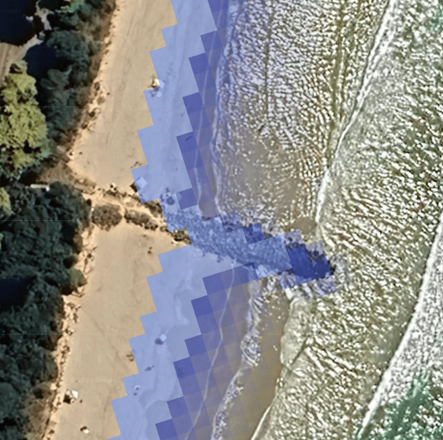
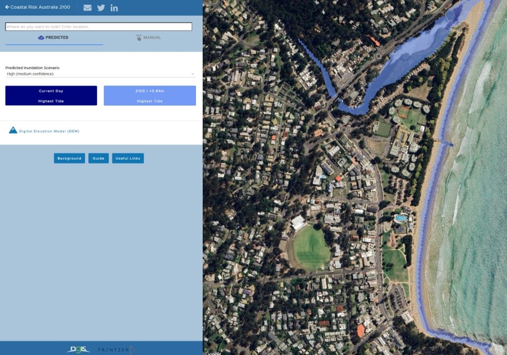
Based on the mandate co-author’s interpretation of Lorne Sea Level predictions for Earth Year 2100 https://coastalrisk.com.au/viewer (see images below). By 2100, high tide projections for Lorne indicate sea levels will be 85 cm higher than today, submerging the groyne and parts of the foreshore, as indicated by light blue shading. This estimate is based on historical warming and ice melt trends, averaging multiple climate models. It does not account for storm tides, which would exacerbate impacts.
DATA COLLECTION AND ANALYSIS
Your team Operator will have access to some or all of the below Osprey Lab Unit Capsule instruments in order to collect and analyze data across various time periods. The Operator will work onsite with the instruments needed to generate actionable climate scenarios (Priority Classification Futures).
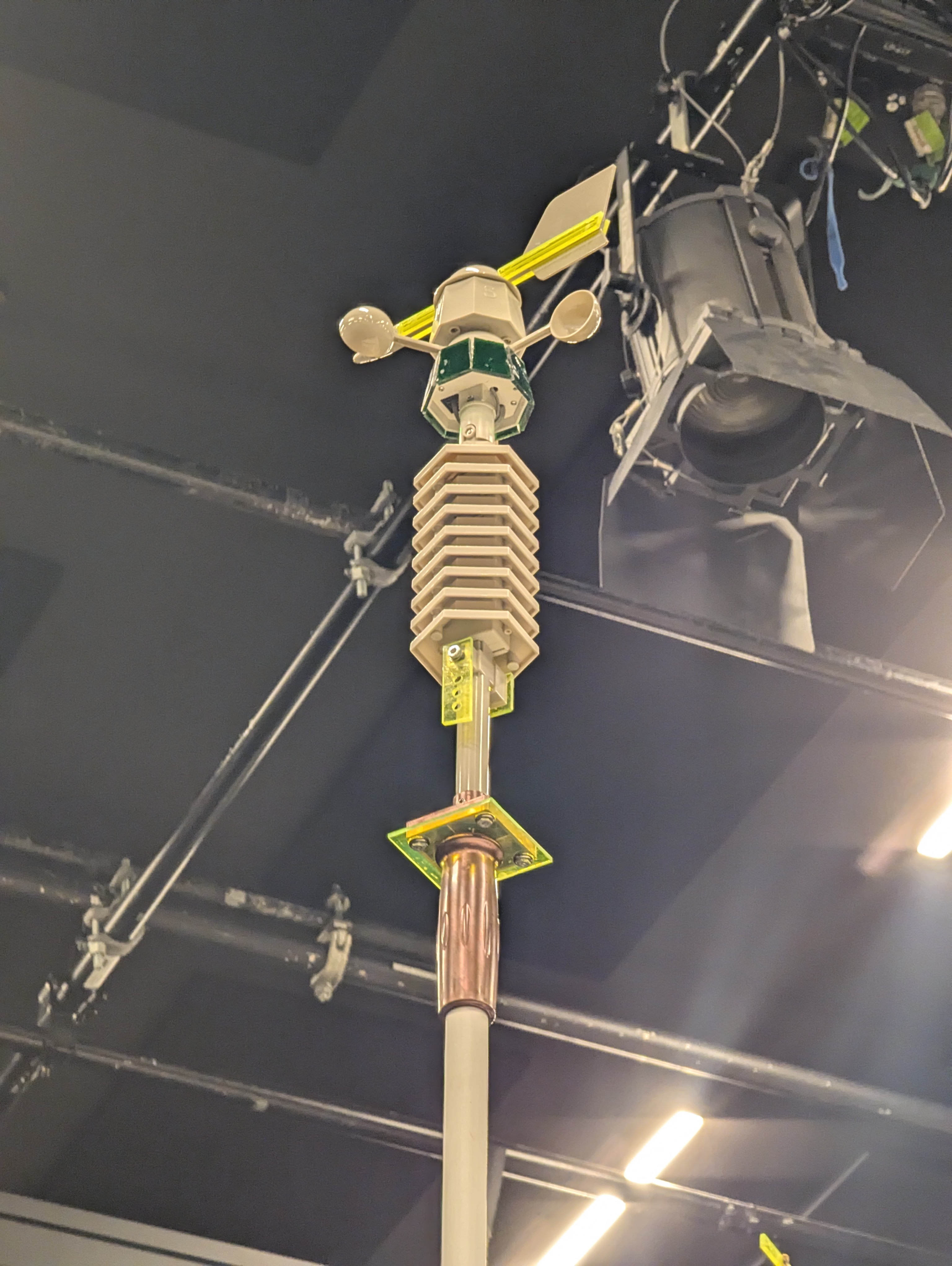
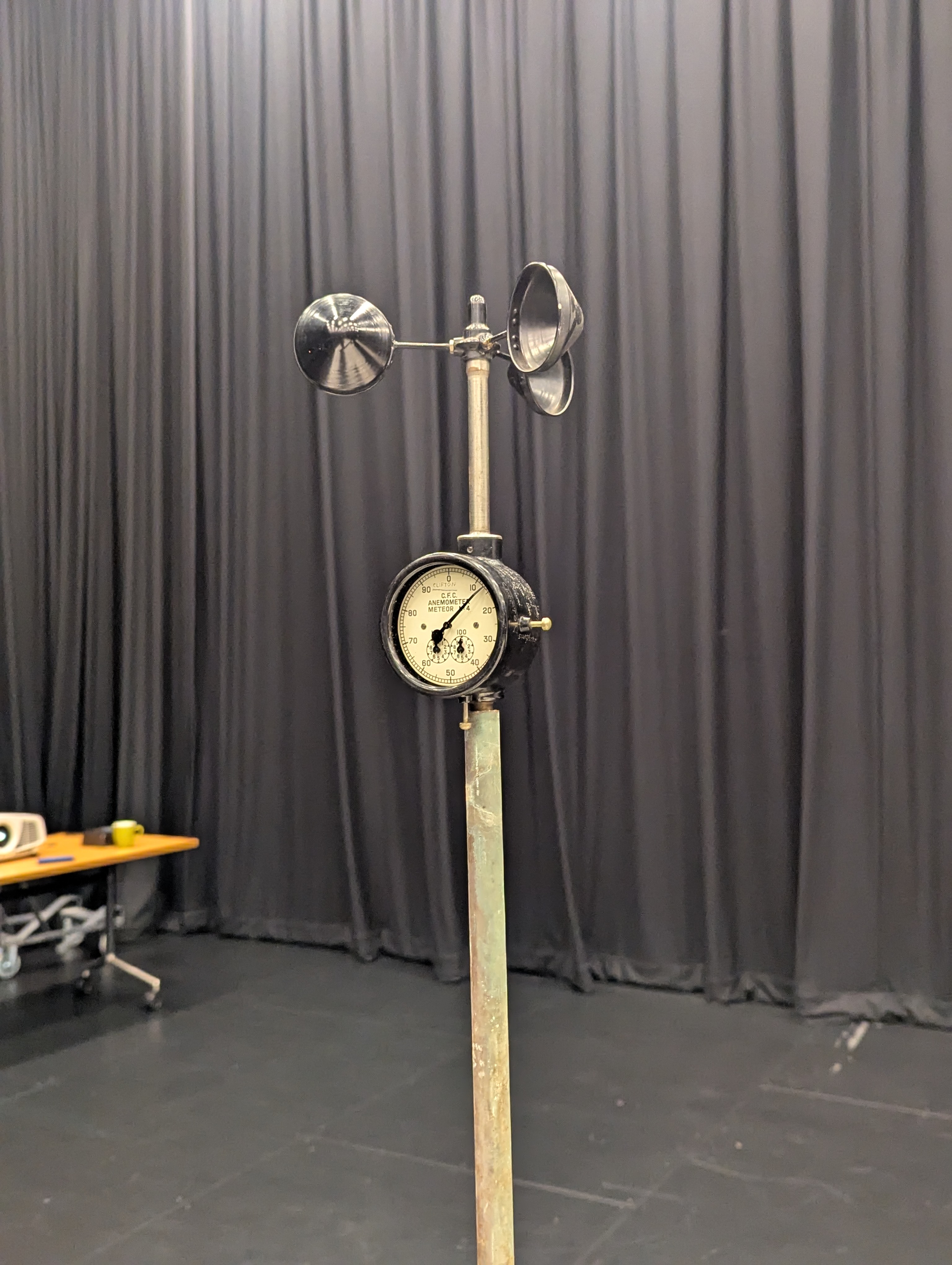
• ClimaScan AR
A wearable smartglass device with a holographic display, the ClimaScan 3000 provides real-time visualization of temperature, humidity, and precipitation. Essential for tracking weather patterns in rapidly changing environments, it helps forecast extreme events like droughts or floods. Calibration is critical to maintaining data accuracy, and it should be protected from extreme heat to preserve sensor functionality.
• AirQual module
This sensor maps air quality by detecting pollutants such as CO₂, NOx, and particulate matter. Perfect for use in industrial areas or urban centers, it identifies pollution hotspots and ensures environmental compliance. Operators should avoid high winds and restricted airspace to maintain safe and accurate deployment.
• HydroProbe module
The HydroProbe analyzes water quality by measuring chemical composition, pollutants, temperature, and pH levels. Ideal for monitoring freshwater ecosystems affected by industrial discharge or agricultural runoff, it requires thorough cleaning between uses to prevent cross-contamination and is less effective in sediment-heavy waters.
• SoilSense module
A portable scanner with a retractable probe, SoilSense evaluates soil health by measuring nutrients, organic matter, and contaminants. It is particularly useful for agricultural or reclamation projects, offering instant diagnostics. Operators should use it cautiously in compacted soils to avoid damage to the probe.
• Entity scanner
This wearable device monitors biodiversity by cataloging species and tracking population trends with AI-powered recognition. Effective in assessing habitat health and documenting species, it is highly useful for conservation projects. Users should ensure adequate battery life for extended fieldwork and proper settings for diverse ecosystems.
• Temporal Navigator
A wrist-worn device ensuring temporal accuracy, the Temporal Navigator allows precise navigation of time and space. Critical for maintaining temporal stability during missions, it must be handled with care to avoid misalignment, which could disrupt mission objectives.
• GeneEdit Kit
A portable genetic modification benchtop tool, the GeneEdit Kit enables precise and ethical alterations to genomics in order to meet mission parameters. Best suited for deployment in sensitive environments (eg Osprey Delegate capsule), it requires secure handling to prevent unauthorized access and adherence to established ethical protocols.
PRIORITY CLASSIFICATION ENTITIES:
As part of this broader framework for Priority Classification Futures, delegates are tasked with identifying and managing Priority Classification Entities, as outlined in the Entity Taxonomy Handbook. These entities represent the most critical components of Earth’s ecological and social systems that require prioritized conservation, management, and restoration efforts. Priority Classification Entities include high-value ecosystems, endangered species, critical habitats, and key socio-environmental systems, whose stability and health are essential to maintaining the balance of our planet’s resources.
Delegates must assess the vulnerability and resilience of these entities, utilizing advanced monitoring tools and data analytics to track their status and adapt management strategies accordingly. This involves classifying entities into various priority levels based on their ecological significance, cultural importance, and susceptibility to environmental threats, with higher-priority entities receiving more focused conservation efforts and resources.
Please note, on rare occasions classifications may fail and an Unforeseen Entity Temporal Rupture may occur. Many entities were generated during the Schism and are still be in operation across delegation timespace.
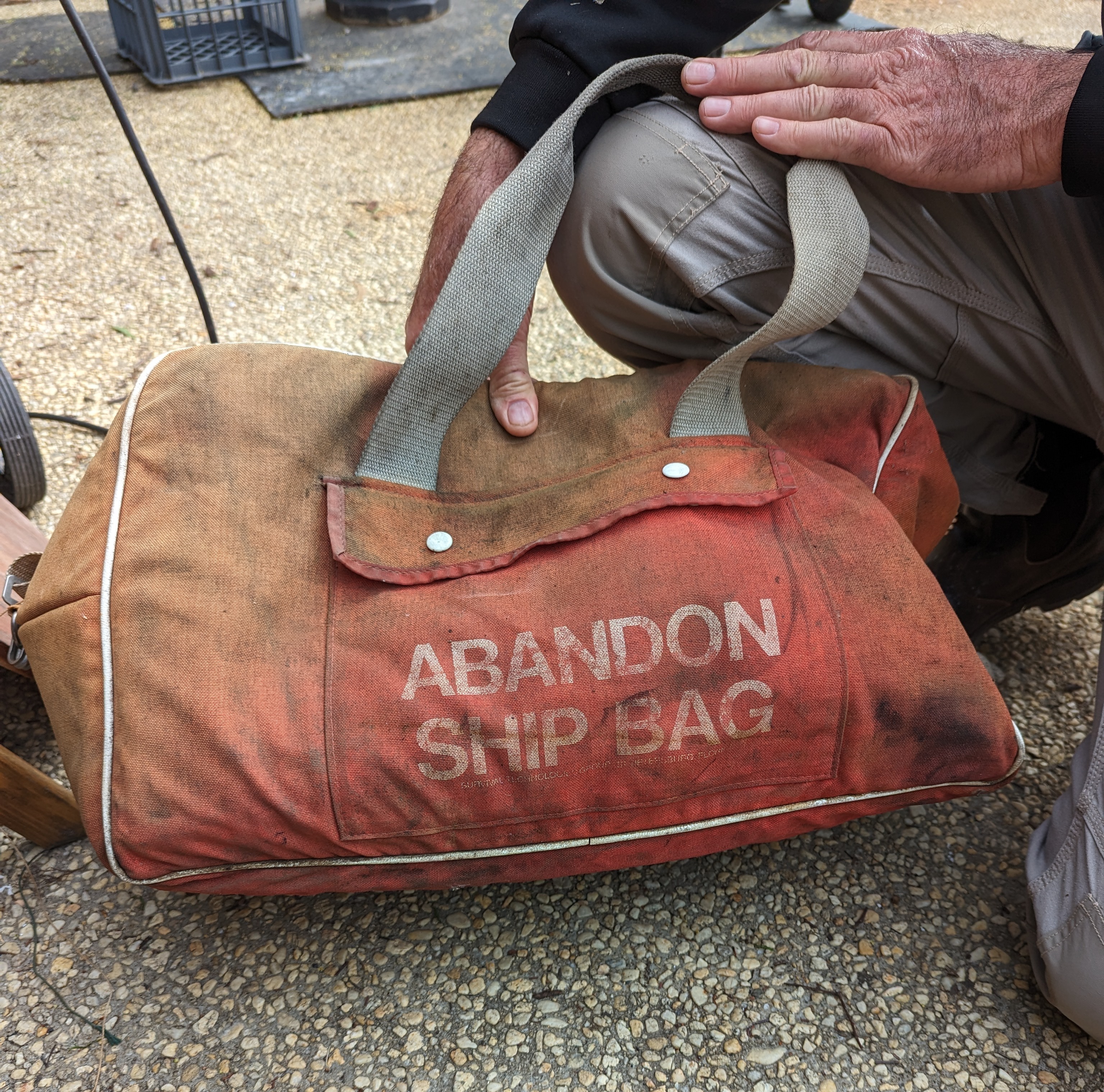
ABANDON SHIP PROTOCOL
In the unlikely event that a mission becomes untenable (ie due to Unforseen Entity Temporal Rupture) and you must abandon ship, DFAUS has established a comprehensive protocol to ensure your safety and the integrity of the timeline:
1. Immediate evacuation: Upon receiving the abandon ship order, delegates must immediately cease all mission activities and proceed to the designated evacuation points.
2. Temporal stabilization: Activate your temporal stabilization device to secure your current time coordinates and prevent any temporal anomalies during evacuation.
3. Secure data: Ensure all collected data is securely transmitted to the central DFAUS database. This step is crucial to preserve the integrity of the mission’s findings.
4. Emergency transport: Utilize the emergency transport beacons to signal for immediate extraction. These beacons are equipped with advanced temporal navigation to ensure a safe return to the present.
5. Debriefing and assessment: Upon return, delegates will undergo a thorough debriefing to assess the situation and determine the cause of the mission failure. This information will be used to improve future missions and protocols.
